How Land Realtors like myself Use LiDAR to Sell Property (And How You Can Understand the Map)
If you’re buying or selling land, you may come across something called a LiDAR map. It might look like a shaded or color image of the land—but it’s much more than a pretty picture. The ones I use are shaded and are sourced from the USGS.
What Is LiDAR?
LiDAR stands for Light Detection and Ranging. It uses lasers from planes or drones to scan the ground and create a super-detailed image of the land’s surface—even under trees and thick brush.
As land a specialists, I use LiDAR maps to:
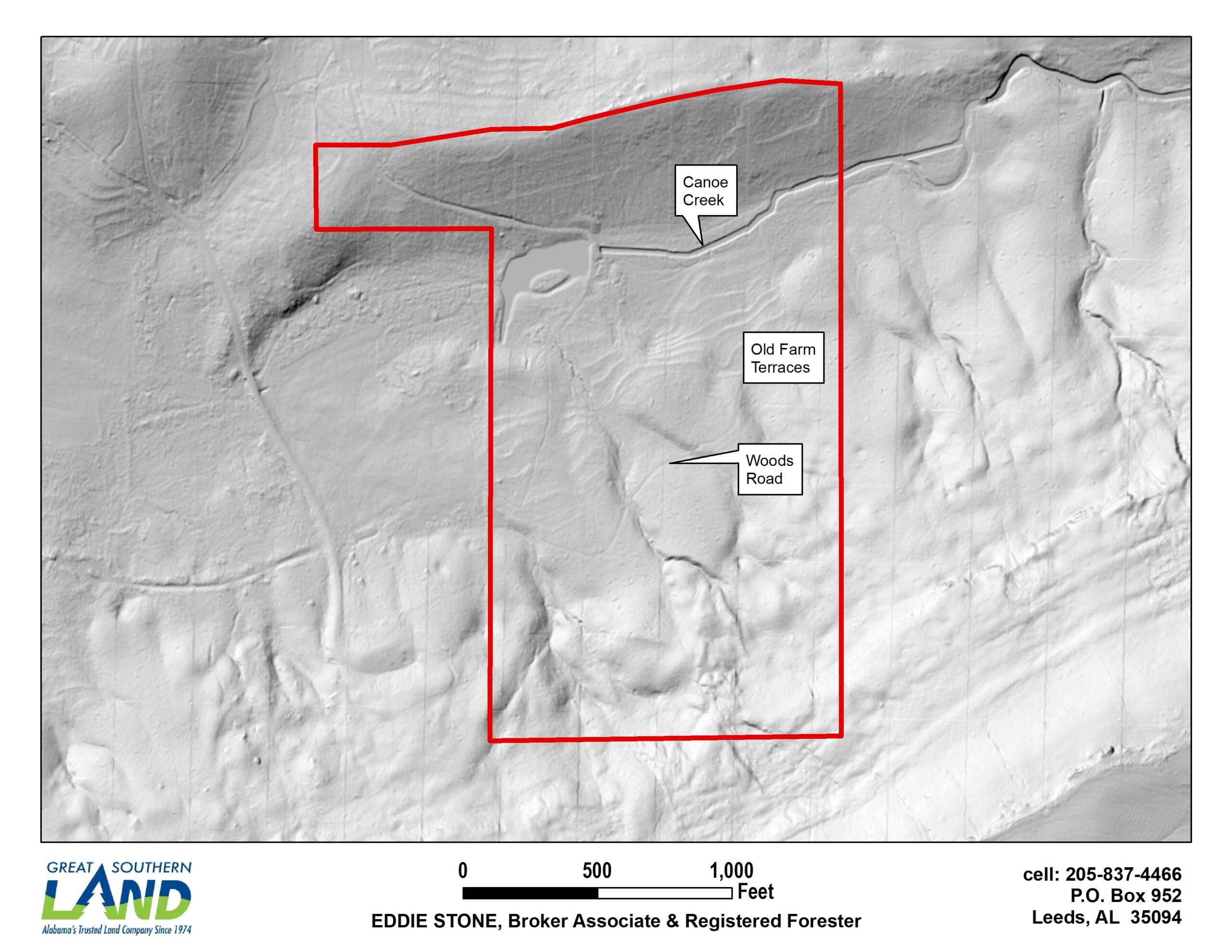
- Show the natural shape of the land—like dips, hills, ridges, and flat spots
- Point out buildable areas or ideal places for driveways or cabins
- Reveal old logging roads, trails, abandoned dams, old farm terraces or creeks that aren’t visible on foot or from an aerial photo
This helps buyers understand what they’re really getting, especially if the land is hard to walk or covered in trees. For example if a buyer wants to install a new road, a LiDAR map will show if any old roads exist and if so those will be prime locations for a new road.
How You Can Read a LiDAR Map
Even without labels or lines, you can learn a lot by just looking at how the light and shadows fall on the map:
- Light areas usually mean flatter ground
- Dark or shadowed areas often show lower ground, dips, side slopes or valleys. The darker the shade the steeper the slope.
- Curved shapes might show hills or ridges
- Flat-looking areas are often great for building or farming
It’s a bit like looking at the land from above and seeing the highs and lows without trees in the way.
Why It Matters
If you’re buying land, a LiDAR map helps you spot good building sites, plan access roads, and avoid problem areas.
If you’re selling, it helps you show the true value of your property—especially if it’s wooded or hard to explore.
See the LiDAR map below of one of my listings:
This map is based on publicly available LiDAR data and is provided for informational purposes only. It is not a legal survey and should not be used as a substitute for a survey conducted by a licensed professional land surveyor.